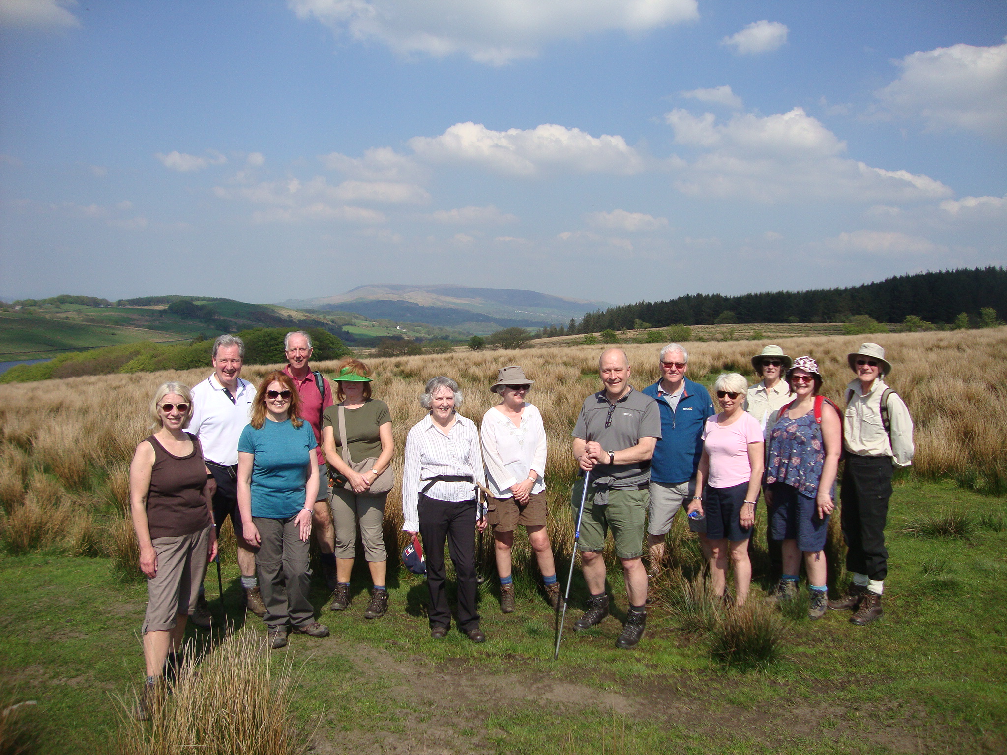
Walks around Wilpshire
PARISH WALK 2019
—————————————————————-
Walking Wilpshire
Wilpshire and surrounding parishes have an excellent and comprehensive network of public footpaths, ginnels, tracks and bridleways which repay those who use them with some wonderful views, interesting landscapes and varied terrain. Above all, they offer the possibility to enjoy healthy exercise and fresh air without costing a penny.
The local footpath network can be easily accessed from all parts of Wilpshire and routes can be followed to suit all abilities and levels of fitness from a stroll or to gain access to a long distance treck. Indeed, the long distance Wainwright’s Way, celebrating the late Alfred Wainwright’s life and linking Blackburn to the Lake District by public footpaths, passes through the area at Dean Clough as does the 291 mile long Lancashire Way. And, every resident of Wilpshire can boast that they can leave their front door and walk all the way to Scotland without ever passing through a large town. Now there’s a challenge!
In order to encourage residents to use our local footpath network the Parish Council is developing a series of local walks of varying length and difficulty. These will be published on our website over the coming years. Details of the first three are below. All routes will follow public rights of way though the Parish Council cannot accept responsibility for changes which take place after publication. Route descriptions are as accurate as possible and have been checked but those using them do so at their own risk. The Ordnance Survey Explorer Map No 287 West Pennine Moors all public rights of way in our area in great detail and may be of additional assistance in route finding.
Do get out and use our local public footpath network and enjoy Wilpshire’s countryside.
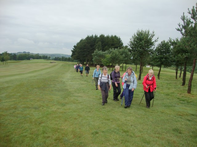
Walkers crossing Wilpshire Golf Course
———————————————————————————————————————————————————
Wilpshire Walk 1 Across Wilpshire Moor
Distance: 3.5 miles moderately easy
Starting Point: Wilpshire Methodist Church
Terrain: Hard surfaces, pavement, fieldpaths, road
This walk leads you out of the built up area and on to the ridge of Wilpshire Moor with lots to see along the way
Route: Walk down Ribchester Road towards Salesbury. TURN RIGHT into Somerset Avenue and walk to the end where it joins Whalley Road. TURN LEFT on to Whalley Road towards Whalley. Walk down Whalley Road as far as the entrance to Carr Hall. CROSS WHALLEY ROAD and pass through the small metal gate set in the wall to the left of the main entrance. Follow the left hand side pavement up the driveway of Carr Hall. Follow the footpath markers through the grounds of Carr Hall. You will cross a footbridge and eventually come to a gate into a field.
(The modern Carr Hall sits on the site of its ancient predecessor which was a yeoman’s farmhouse originally linked to the Talbot Family.)
Climb up a bank ahead of you to the right of a fence, not between the fences, to a metal kissing gate and up through a wooded clough. Eventually, the path bears right and follows a fence towards Little Snodworth Farm whose floodlit paddock with caravans you will see ahead. Upon reaching the farmyard walk to the drystone wall ahead with a concrete and asbestos farm building with a curved roof. To the left of this building is a stile in the form of a low, vertical stone slab.
Climb over the stile and follow the public footpath the surface of which Wilpshire Parish Council has improved in recent years. You will come to a stile. Climb it and continue straight ahead across boggy ground to another stile. Climb it and keep straight ahead following the remains of a track. When this peters out you will see another stile ahead. Climb it and go straight ahead but after 50 metres begin to BEAR LEFT up the shoulder of a hill but don’t go to the top of it. Ahead you will see trees and eventually a wall marking the boundary of the golf course.
(This part of the route from Little Snodworth to Hollowhead Lane is very scenic with distant views up Ribblesdale to Pendle Hill, Clitheroe, the fells of the Yorkshire Dales and Bowland and out to Preston and the coast with Blackpool Tower on the horizon)
On reaching the golf course wall you will find a wooden kissing gate, also provided by the Parish Council, together with a noticeboard. Pass through the kissing gate and you will find a well-placed bench on which to sit and admire the distant views to the Fylde Coast and Longridge Fell. This bench was provided by Wilpshire Parish Council in 2010 and is made from recycled plastic bags.
(Wilpshire Golf Course was established in 1890 and the present course was designed by James Braid a renowned golf course architect. He made excellent use of the natural features of Wilpshire Moor)
Continue straight ahead following the black & white markers and wooden waymark posts. You will cross a fairway, keeping RIGHT of a green ahead with a flag and beyond it keep to the RIGHT of a plantation of Scots Pine trees. Keep following the waymarkers which lead you to the LEFT of the next Scots Pine plantation and keep to the edge of the fairway leading downhill. Head to the RIGHT of the stone footbridge (do not cross it) then walk in the rough grass of another fairway towards the houses on Hollowhead Lane. (Look out for golfers teeing off ahead and flying golf balls)
Ahead you will eventually see, to the left of a tee, a stile in a wall leading on to Hollowhead Lane. TURN RIGHT and walk down the Lane to the traffic lights and follow Ribchester Road back to your starting point.
———————————————————————————————————————————————————
Wilpshire Walk 2 Through Wilpshire’s Back Door
Distance: 2 miles easy
Starting Point: Wilpshire Methodist Church
Terrain: pavement, rough track, fieldpaths
This short walk takes you along paths between gardens, along hidden ways as well as a brief foray into open countryside on the bridleway through Tippings Farm.
Route: Head down Ribchester Road towards Salesbury as far as the last house in Wilpshire on the right hand side of the road with the boundary sign outside. TURN RIGHT on to a track leading to Salesbury Cricket Club.
(Salesbury Cricket Club was founded in 1906 and originally played in the Blackburn Sunday School League. Today, this flourishing club has three senior sides in the Ribblesdale League. The view from the ground must rank as one of the most beautiful in Britain)
Just before the clubhouse TURN RIGHT into a ginnel leading to The Hazels housing estate. At the other end of the ginnel GO STRAIGHT AHEAD through the estate then BEAR LEFT where the street branches and follow another ginnel/path passing a large detached house on your left. You will reach Vicarage Lane at the other end. TURN LEFT on to Vicarage Lane and head downhill. The Lane bends right and crosses a bridge over the railway.
(The Ribble Valley Line opened to Clitheroe in 1846 and to Chatburn in 1850. When the Settle-Carlisle Line opened in 1875 the Lancashire & Yorkshire Railway decided to extend the Line to Hellifield and make a junction there. The extension opened in 1880. The L&Y and Midland Railway operated joint express trains to Scotland from Manchester using this route. The Line closed to passengers in 1962 and survived as a diversionary route for the West Coast Main Line. After a public campaign, a regular passenger service to/from Clitheroe was reintroduced in 1994 with a Sunday service to Hellifield. The Line is also part of the Strategic Freight Network. All told, a lucky survivor.)
TURN LEFT on to Lyndale Avenue and CROSS IT. Between number 5&7 Lyndale Avenue TURN RIGHT up a back lane which leads to Whalley Road. At Whalley Road TURN RIGHT and walk along it to Durham Drive (2nd turning on the right).
(You will pass the imposing building once known as Wilpshire Orphanage. It was opened in 1891after five years of fundraising and was the inspiration of James Dixon. It provided a home for destitute children aged 4 to 12 years. Priority was given to children without both parents. Another block was added in 1904 so that boys and girls could be housed separately. The Orphanage was later renamed The Homestead and the original building was demolished by the 1970’s. Today it is the headquarters of the charity founded by James Dixon but now known as Child Action North West which continues to support local children and young people in need.)
TURN RIGHT down Durham Avenue walking on the LEFT side pavement. After passing the second house – No3 – TURN LEFT into a public footpath (signed and gated) and follow it to cross over the railway above the entrance to Wilpshire Tunnel (297metres). Immediately over the Tunnel a footpath goes left. TURN LEFT on to this footpath which leads to Somerset Avenue. At Somerset Avenue TURN RIGHT and walk along to Ribchester Road. At Ribchester Road TURN LEFT towards Wilpshire Methodist Church
———————————————————————————————————————————————————
WALK 3 Wilpshire Walks 3 To Foreign Parts!
This walk takes in four civil parishes – Wilpshire, Salesbury, Clayton le Dale and Ramsgreave, visits China Town and skirts the Isle of Man and gives a brief glimpse of Paris as well as offering panoramic views across the Ribble Valley and beyond to the Yorkshire’s Three Peaks – foreign parts indeed!
Distance: 3 miles Grade: Moderate Start & Finish: Wilpshire Methodist Church
From Wilpshire Methodist Church walk down Ribchester Road towards Salesbury Memorial Hall.
(The Hall was built in the early 1920’s as memorial to those local men who died in WW1. The donations to build the Hall came from all four parishes named above and was a very practical idea. The Hall is well used for all kinds of activities involving all ages)
TURN LEFT between Numbers 135 & 137 into a tarmac track marked ‘Private Road’. Descend towards the sewage works and TURN RIGHT just before the works’ entrance at a yellow topped post into a tree lined track. This leads to a field. BEAR LEFT keeping to the left of a pylon. Ahead you will see a stile marked by an orange circular disc. Climb the stile and walk through the trees to a footbridge over the Showley Brook.
(The Brook joins the River Ribble in Dinckley. The footbridge was built here many years ago after a schoolboy, who lived at China Town, fell in on his way to Salesbury School and nearly drowned)
Over the footbridge BEAR LEFT following a worn grass path through the field and slightly uphill towards a wire fence and line of trees.
The footpath bears right then ahead to a metal farm gate and stile. Climb the stile and head towards two metal farm gates with yellow waymarkers. After the second gate go up the steep hill and head towards the right of two trees on the skyline. Towards the top of the field head for the top right hand corner to the remains of a wooden shack. AHEAD you will see a metal farm gate and stile.
(The remains of a shack and those of several others nearby are all that is left of a settlement known locally as China Town. The settlement grew after WW1 when farmers allowed people to build wooden bungalows on their land in return for a small annual rent, At first they were used as weekend retreats having no mains services but during and after WW2 many were lived in permanently as housing was in short supply. The shacks were last used in the early 1990’s)
At the tarmac road TURN LEFT and go up the hill.
(You may wish to take a breather as you climb and to turn around to admire the panoramic view across the Ribble Valley. From left to right you will see the wooded flat summit of Beacon Fell and behind it Parlick and Fairsnape Fell. Longridge Fell is nearer with the Bowland Fells beyond. Waddington Fell is identifiable by its wireless mast. Beyond you might spot the flat topped summit of Ingleborough if the weather is clear. Further to the right are the fells behind Settle which are in the Yorkshire Dales National Park)
At the top of your climb you will reach a cattle grid and concrete road with a nursery school to your left. CONTINUE AHEAD and follow the road bending left at Croft Cottage to pass in front of Ramsgreave Hall.
(Ramsgreave Hall was once the home of a yeoman farmer and is quite an ancient site but now split into more than one dwelling)
Just beyond the large white detached house, Ramsgreave Hall Barn, TURN LEFT along a gravel track to the far end and a wooden farm gate with yellow waymarker. GO AHEAD along a green track to another wooden farm gate. At this gate BEAR RIGHT towards a pylon and the houses of Hollowhead Avenue on the far hillside. Keep heading for the pylon and an orange topped pipeline marker. On the right you will see the distinctive roof of Ramsgreave Reservoir.
(This reservoir contains purified drinking water to supply Blackburn and District including Wilpshire hence the high fence and plethora of security cameras. Can you spot the trig pillar on Wilpshire Moor? On this section of the walk you skirt the roads to the right named Isle of Man and Paris)
Before reaching the pylon you will see a stone built house below you to the left. Head down the steep slope towards it. When you reach it keep to the RIGHT of the wooden sheds to a stile. Climb the stile and keep STRAIGHT AHEAD to join a concrete road down to Knowsley Road. Upon reaching Knowsley Road TURN LEFT back up to Wilpshire Methodist Church. NB The section of the route down from Ramsgreave Hall can be very boggy after wet weather. In that case return down Ramsgreave Road to the Co-op and back via Knowsley Road to your starting point.